XLSForm Converter: unlock a world of surveys with our brand new QGIS plugin
Today marks the initial release of our brand-new QGIS plugin, XLSForm Converter.
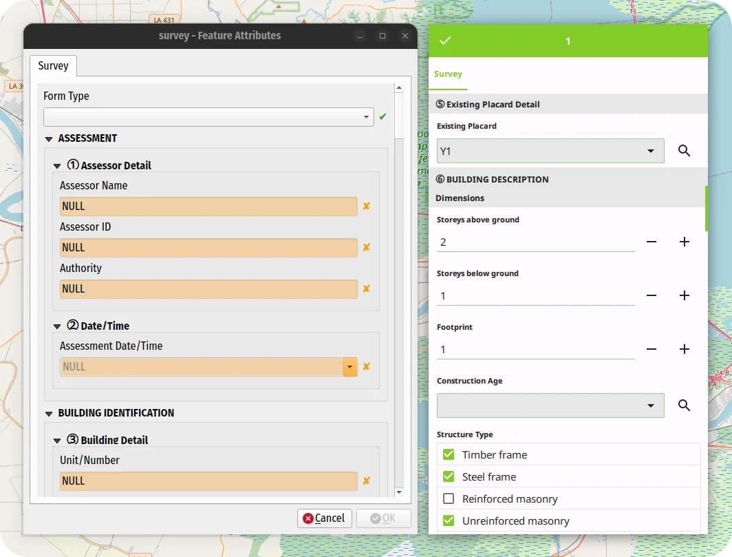
As the name suggests, the plugin converts XLSForm survey files into ready-to-use QGIS projects with a preconfigured survey attribute form.
Migrating to QField was never easier!
Offline WMS - Benchmarking raster formats for QField
What are we looking for?
We would like to use WMS offline on QField. For that, we need to figure out what is the best way to get a raster from a WMS and which format is the most efficient (size and performance).
In this post we’ll show you is how to generate the ideal raster file from a WMS and the results of our efficiency tests for the the different raster formats.
How to filter features in QGIS using the graphical processing modeler
This article describes a new algorithm for the processing modeler called feature filter algorithm. If you are already familiar with ETL concepts and the graphical modeler, you can directly jump to the section the feature filter algorithm .
Building workflows for repetitive tasks
When building workflows for simple or complex geodata infrastructures, one of the most common tasks one encounters is to …