Outdated documentation
The latest documentation was moved to docs.qfield.org
A short press on the GNSS button will turn on the GNSS and center to the current location once positioning information is available.
Activate edit mode and press on the target button, the cross in the center means it is using GNSS positioning.
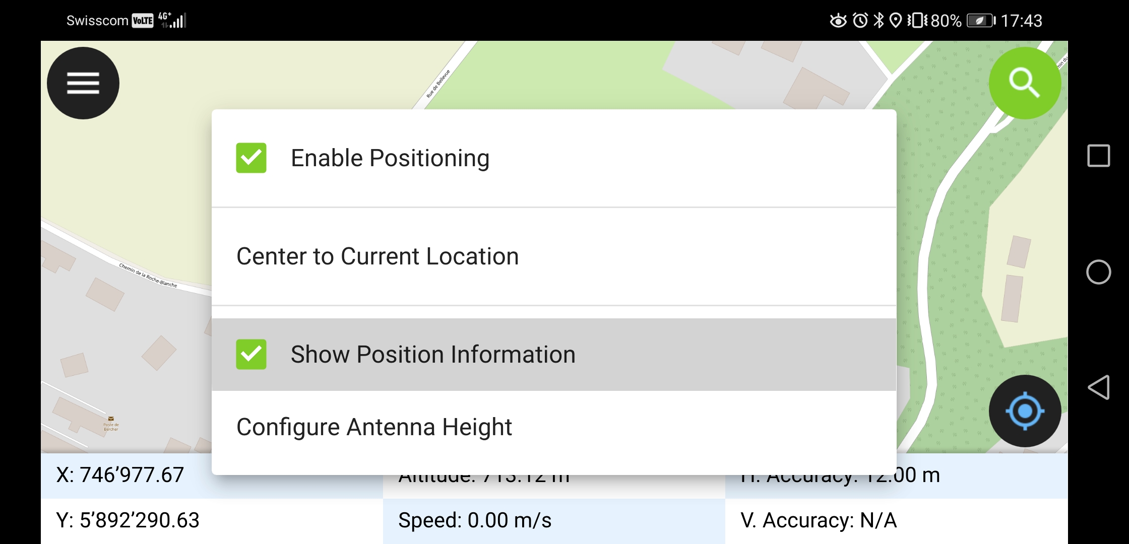
A long press on the GNSS button will show the positioning menu.
GPS Vaihtoehdot valikossa voit asettaa sijainnin näytön joka näyttää nykyisen sijainnin joka on vastaa projektin koordinaattijärjestelmän sijaintia sekä sijainnin tarkuustiedot.
Note
Jos näet WGS84 lat/lon tiedot oman projektisi koordinaattitietojen sijaan, et luultavasti ole saanut vielä signaalia.
QField supports connecting external GNSS antennas via bluetooth.
In settings -> positioning, paired bluetooth devices can be scanned and chosen as position source.
Make sure no other app like mock location providers are using the bluetooth antenna.
It is possible to provide a mock location via a separate android app to QField. There are several options for this, one of them is Android NTRIP Client.
Käyttääksesi tätä on Sinun otettava käyttöön simuloidut sijainnit Android laitteessa.
For more information how to setup high precision measurement and add quality indication metadata to collected features, see the corresponding GNSS documentation.