Outdated documentation
The latest documentation was moved to docs.qfield.org
A short press on the GNSS button will turn on the GNSS and center to the current location once positioning information is available.
Activate edit mode and press on the target button, the cross in the center means it is using GNSS positioning.
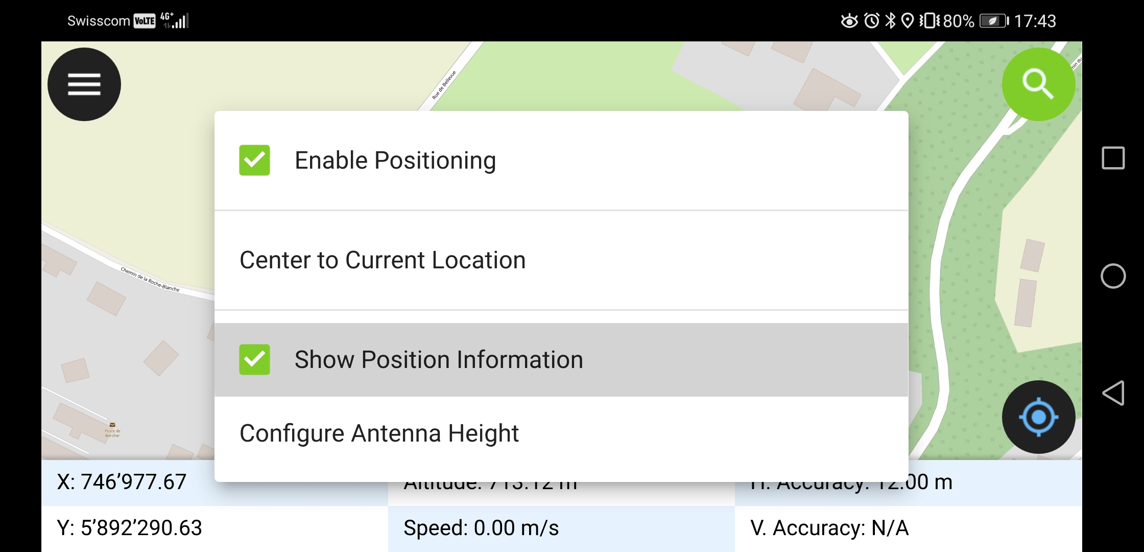
A long press on the GNSS button will show the positioning menu.
Inside the positioning menu you can turn on the positioning display which will show the current coordinates which are reprojected into the project CRS along with precision information.
Note
If you see WGS 84 lat/lon information instead of information in your project CRS, you probably have no signal yet.
QField supports connecting external GNSS antennas via bluetooth.
In settings -> positioning, paired bluetooth devices can be scanned and chosen as position source.
Make sure no other app like mock location providers are using the bluetooth antenna.
It is possible to provide a mock location via a separate android app to QField. There are several options for this, one of them is Android NTRIP Client.
To use this you have to enable mock locations on your Android device.
For more information how to setup high precision measurement and add quality indication metadata to collected features, see the corresponding GNSS documentation.