Outdated documentation
The latest documentation was moved to docs.qfield.org
By Ryan Bell, GIS Consultant, Delta-Simons Environmental Consultancy
To conduct ecological surveying more efficiently than has been previously achieved through traditional non-digital techniques, using QField as a medium for standardised and flexible field data collection.
To facilitate effective field work, regular consultation with the Ecology team is required to ensure that QField projects are prepared appropriately. Firstly, basemaps comprising aerial imagery and proposed development plans are prepared by georeferencing and constructing pyramids in QGIS. Point, line and polygon vector layers are then created to support digitisation and associated data collection. Using a range of widgets, attribute fields are customised to meet the requirements of the Ecology team. These include:
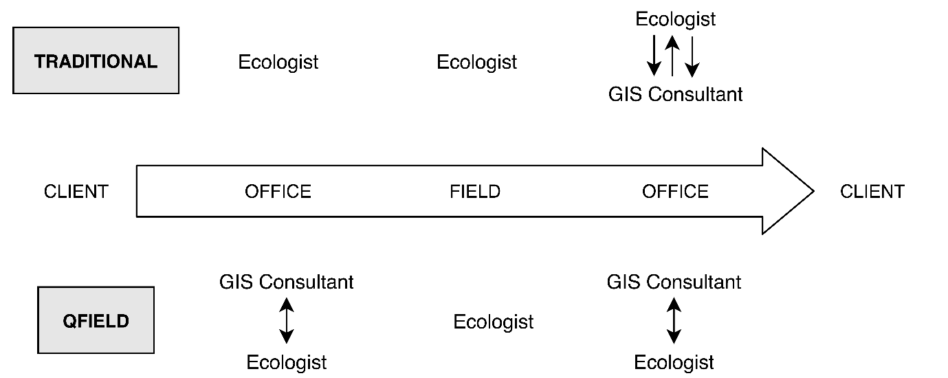
Delta-Simons are saving approximately 40% of the time previously consumed by traditional ecological field data collection. QField has significantly improved the ecological surveying workflow by: