Outdated documentation
The latest documentation was moved to docs.qfield.org
A short press on the GNSS button will turn on the GNSS and center to the current location once positioning information is available.
Activate edit mode and press on the target button, the cross in the center means it is using GNSS positioning.
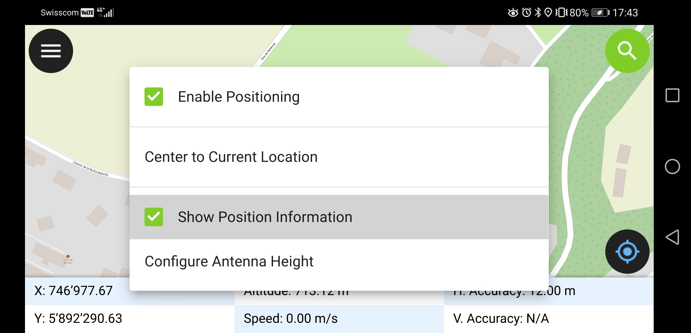
A long press on the GNSS button will show the positioning menu.
Im Positionierungsmenü kann die Positionierungsanzeige eingeschaltet werden, welche die aktuellen Koordinaten im Projekt-KBS und Präzisionsinformationen anzeigt.
Note
Falls WGS 84 Länge/Breite Informationen angezeigt werden anstatt Koordinaten im Projekt-KBS ist vermutlich noch kein Signal verfügbar.
QField supports connecting external GNSS antennas via bluetooth.
In settings -> positioning, paired bluetooth devices can be scanned and chosen as position source.
Make sure no other app like mock location providers are using the bluetooth antenna.
It is possible to provide a mock location via a separate android app to QField. There are several options for this, one of them is Android NTRIP Client.
Dafür musst du auf deinem Android Gerät mock locations aktivieren.
For more information how to setup high precision measurement and add quality indication metadata to collected features, see the corresponding GNSS documentation.