Outdated documentation
The latest documentation was moved to docs.qfield.org
Gran parte delle impostazioni che QGIS offre sono direttamente supportate da QField senza nessuno sforzo ulteriore.
All style settings from QGIS are directly supported by QField. This includes all renderer types like graduated, categorized, rule based, 2.5D as well as data defined symbology.
In QField, objects are identified with a name. The expression to generate this name can be defined by opening the attribute table in QGIS and switching to the form view. Choose the appropriate field or an expression in the list there. Starting from QGIS 3, this can be done directly from the page.
The display expression is also used to search in layers.
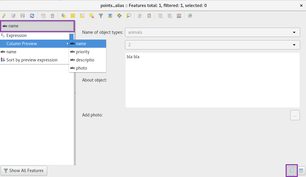
The display expression will be used to represent features with an identification string throughout QField.
Alcuni layer di un progetto sono presenti unicamente per motivi di visualizzazione. Questi layer, non devono essere mostrati quando un utente tocca un qualche punto per identificare degli oggetti.
Alcuni altri layer servono come fonte di informazioni e non dovrebbero venir modificati dall’utente. È possibile proteggere i layer dalla modifica degli attributi o dall’aggiunta e rimozione di feature.
It is also possible to configure which layers are searchable.
To configure identify, readonly and searchable behavior, go to the page and activate the checkboxes to match your desired behavior.
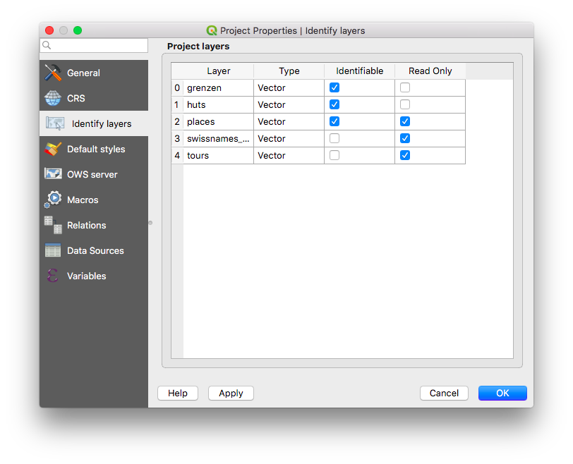
Configuration of layers that will not be identifiable, not modifiable and/or not searchable.
Quando si digitalizza una nuova feature, i nuovi punti possono essere agganciati alle geometrie esistenti.
All configuration can be done in ( in QGIS 2.x).
E” possibile agganciarsi ai nuovi punti.
It is also possible to only snap to one or a few layers.
The snapping tolerance can be specified in map units or pixels.
In almost any case, the units should be set to pixels. We made good experiences with a tolerance value of 20.
GPS devices are capable of measuring the altitude next to the current 2D position on the earth surface. This information can be saved