Outdated documentation
The latest documentation was moved to docs.qfield.org
A short press on the GNSS button will turn on the GNSS and center to the current location once positioning information is available.
Activate edit mode and press on the target button, the cross in the center means it is using GNSS positioning.
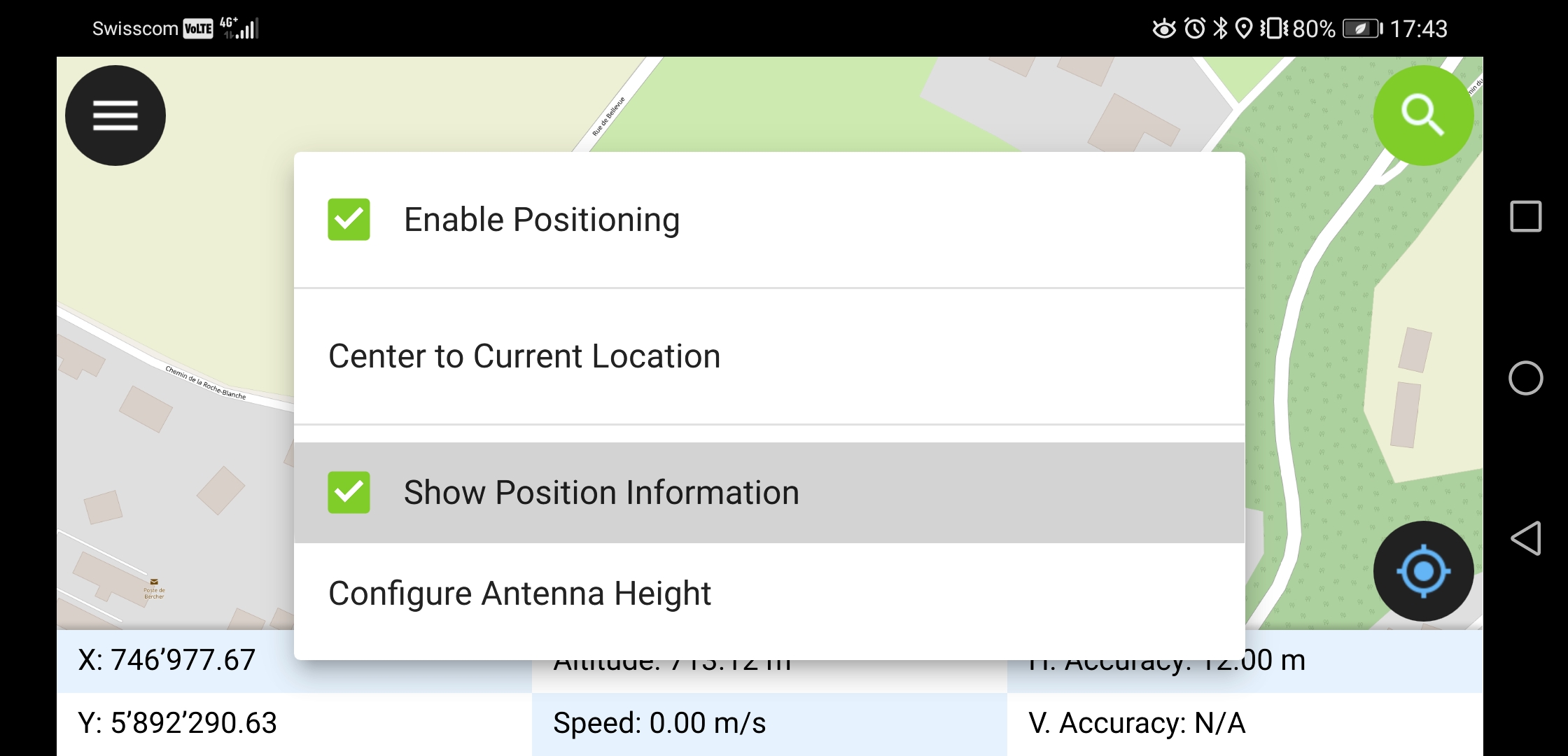
A long press on the GNSS button will show the positioning menu.
在定位菜单中,可以打开定位信息显示开关,显示当前坐标信息以及定位精度信息,坐标信息被自动转换为项目CRS。
Note
如果你看到的是WGS 84的经纬度坐标,而不是项目使用的CRS坐标值,很可能是因为还没有GPS信号。
QField supports connecting external GNSS antennas via bluetooth.
In settings -> positioning, paired bluetooth devices can be scanned and chosen as position source.
Make sure no other app like mock location providers are using the bluetooth antenna.
It is possible to provide a mock location via a separate android app to QField. There are several options for this, one of them is Android NTRIP Client.
要使用此功能,您必须在Android设备上启用模拟位置 <https://www.youtube.com/watch?v=v1eRHmMiRJQ>。
For more information how to setup high precision measurement and add quality indication metadata to collected features, see the corresponding GNSS documentation.