Goal
To conduct ecological surveying more efficiently than has been previously achieved through traditional non-digital techniques, using QField as a medium for standardised and flexible field data collection.
Project Requirements
To facilitate effective field work, regular consultation with the Ecology team is required to ensure that QField projects are prepared appropriately. Firstly, basemaps comprising aerial imagery and proposed development plans are prepared by georeferencing and constructing pyramids in QGIS. Point, line and polygon vector layers are then created to support digitisation and associated data collection. Using a range of widgets, attribute fields are customised to meet the requirements of the Ecology team. These include:
Style
drop-down list of selectable styles tailored for conducting ecological surveys
Scale
drop-down list of selectable scales for point and line feature
Info
space for inserting a feature description
Image
location for images to be captured and stored
Geometry
contains self-populated geometry values, e.g. area, perimeter, length
Timestamp
records the time and date that a feature was created/last modified
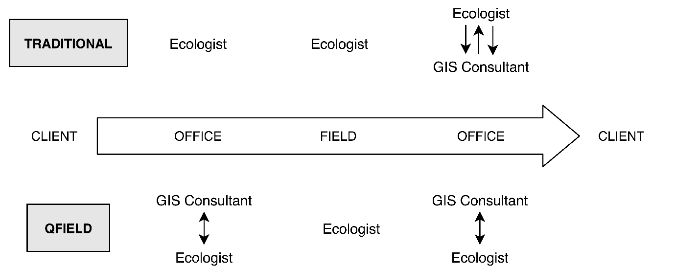
Figure 1 - Overview of the traditional workflow in ecological surveying at Delta-Simons compared with the workflow created using QField. Single-headed arrows indicate the direction of one-way communication, whereas double-headed arrows indicate two-way conversation.
Result
Delta-Simons are saving approximately 40% of the time previously consumed by traditional ecological field data collection.
QField has significantly improved the ecological surveying workflow by:
– Removing the need to recreate GIS outputs from physical drawings
– Reducing the overall amendments required for GIS outputs
– Improving communication channels (see Figure 1.)
– Improving the accuracy and quality of data