The Challenge
Ghana's Tano Offin Forest Reserve, one of the country's most biodiverse areas supporting 569 species including seven globally threatened ones, faced a critical threat. Satellite imagery revealed that without intervention, the forest was projected to lose 56 hectares annually to illegal farming and logging activities. Traditional monitoring methods using "pen and paper" were insufficient to respond quickly to emerging deforestation threats detected by remote sensing. The Alliance of Bioversity International and CIAT, working with local partners including the Ghana Forestry Commission, needed a way to rapidly ground-truth satellite alerts and engage local communities in real-time forest monitoring. The challenge was particularly complex given the rural setting where many community members had limited literacy and technology experience.
The Solution
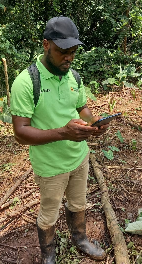
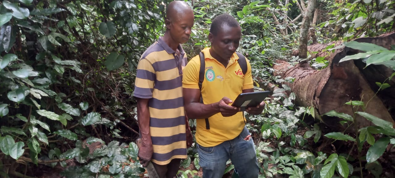
The project team implemented an innovative community-based monitoring system using QField on Android tablets. Twelve young farmers were trained as volunteers to verify deforestation alerts generated by the Terra-i satellite monitoring system, which uses freely available Sentinel 1 and 2 Copernicus satellite data to detect forest changes fortnightly.
The QField workflow was designed for simplicity:
- Volunteers receive GPS coordinates of deforestation alerts on their tablets
- Working in groups of at least two for safety, they navigate to the alert locations
- Using a simple QField form, they confirm whether deforestation is occurring
- They identify the cause (farming, illegal logging, or other activities)
- Photos are captured directly in the form
- Data is synchronized back to researchers and the Ghana Forestry Commission
"The idea is not to confirm whether it's deforestation or not - we can see forest clearing from satellite imagery. The goal is to stop deforestation from expanding. If it's monitored when it's just started, then a farm won't grow from one hectare to 10 hectares."
Accountability team members
The Result
After just one year of implementation (July 2023 to July 2024), the project achieved extraordinary conservation outcomes across 1,044 hectares.
Environmental Impact:
- 71% reduction in deforestation compared to business-as-usual projections
- 38% reduction compared to historical deforestation rates
– Annual deforestation dropped from a projected 56 hectares to just 16 hectares
- 6,911 tons of CO2 equivalent conserved
- 65,303 cubic meters of water recharge protected annually
- 39 hectares of biodiverse forest safeguarded
Community Empowerment:
- 423 households from 6 communities engaged in forest conservation
- 12 young individuals received geospatial training and technology skills
- Communities achieved $2,000 USD in Payment for Ecosystem Services rewards for health clinic construction
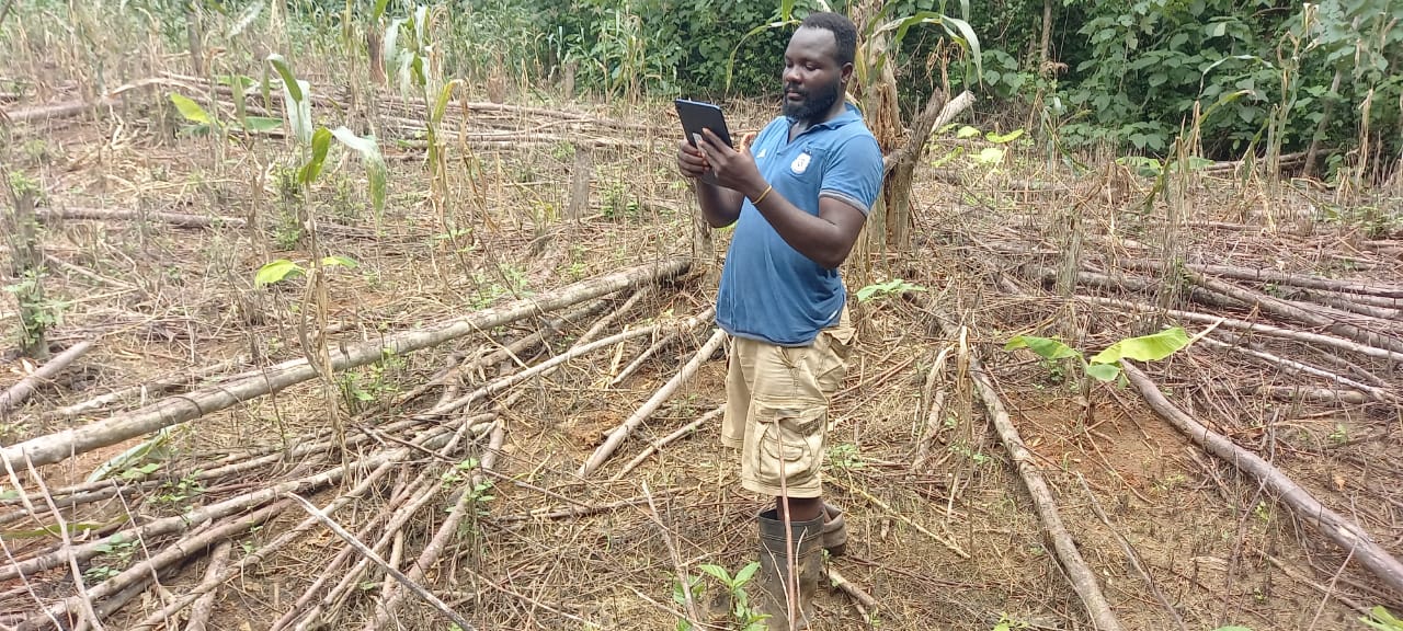
Accountability Team member checks alerts
Scaling Conservation Impact
The success has demonstrated the potential for expanding this model across West Africa and beyond. The Payment for Ecosystem Services approach, combined with QField's accessible technology platform, provides a replicable framework for community-led forest conservation.
"If we expand it to another forest in Ghana or West Africa with this payment for ecosystem services model to motivate communities' self-management of natural resources, then QField feels like a good technological platform to enable them to do that."
The project showcases how mobile GIS technology can bridge the gap between satellite monitoring and community action, turning local residents from potential forest threats into empowered conservation guardians.