River State Survey using QField

Municipality of Milvignes, Switzerland

Goal

In order to assess the structural and morphological state of their water courses, the community of Milvignes needed to survey all the rivers crossing their territory.

Project

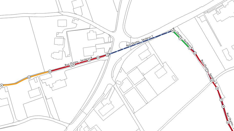
To facilitate the technician's field work (usually done with a map, a notebook and a camera), a QField project was created and made available on a Tablet. Cadastral and river layers were used as basemap.

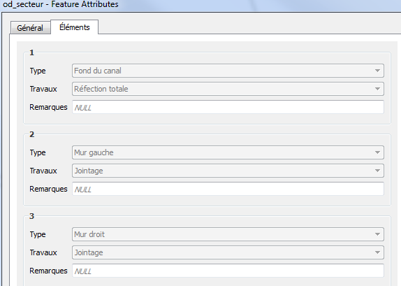
The structure of the input tables was designed along with the technician to assure that it would fit their field requirements. The idea was to have two tables:

Sector table

To draw sectors alongside the rivers and add information about their state and structure. If necessary, pre-defined structural work on the sector elements (wall, bridge, bottom of the canal) could also be documented.
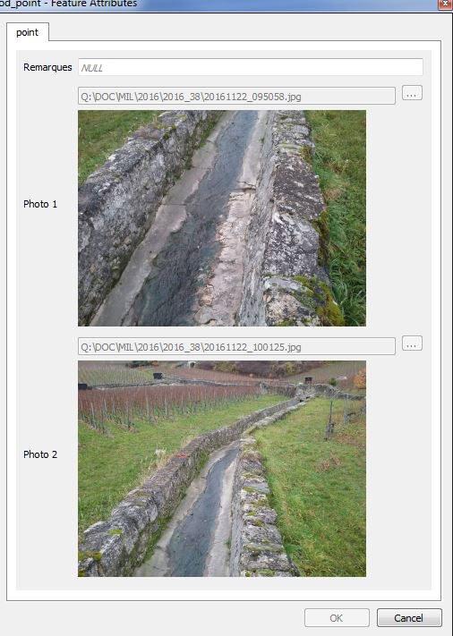
Point table

To take punctual photography of the water courses and of its elements and where necessary add remarks.

river state survey
River State Survey 1
river state survey
River State Survey 2
river state survey
River State Survey 3

Result

In less than 3 days, the technician surveyed successfully all the 10'894 meters of water courses.
Back at the office, it took only 2 hours to treat the data and get the final result:

– Facilitated the field survey
– Accelerated the data treatment

geoconseils milvignes

QField is the leading professional fieldwork app used in enterprise settings for efficient geospatial data collection and management. As a Digital Public Good, QField not only excels in enterprise and professional applications but also contributes significantly to advancing at least six of the United Nations Sustainable Development Goals (SDGs), promoting a more sustainable and equitable future.

Stay in the loop

Subscribe to our newsletter and stay up to date on the latest and greatest!

Open-source

QField is released under the GNU Public License (GPL) Version 2 or above. Developing QField under this license means that you can inspect and modify the source code and guarantees that you will always have access to a QGIS based field data collection app that is free of cost and can be freely modified.

Privacy

View the QField Privacy Policy to learn what information is collected, used and how we protect this.

Credits

QField, QFieldCloud and QFieldSync are developped by OPENGIS.ch. OPENGIS.ch offers consulting, development, training and support for open-source software including QField, QGIS and PostGIS.